Mowing your Own Lawn
May 31, 2013 Leave a comment
By: Chris Fricke, Solutions Engineer
“They say that something like 90% of the world’s information is spatial.”
This is usually the quote I use when I feel I need to explain to people what I do for a living. I then go into how I help municipalities and local governments across the country develop and publish their data out to their local constituents. It makes everyone feel really good and usually distracts from any Buster Bluth references.
The theory that most data is spatial has opened up new doors across business units in local government. Focused apps like the My Government Services, Tax Parcel Viewer and Executive Dashboard have set an expectation that not only will GIS applications display where, but that they will also display what, why, and how.
However, I feel like the quote is missing a key element, 90% of the world’s information is not spatial- it is spatially related. Case in point: the assessor information joined to your tax lots in the Tax Parcel Viewer is not spatial data, it is business data and it probably should not be managed by the GIS folks.
For this reason I would like to introduce the concept of Mowing Your Own Lawn.
Mowing your own lawn is a strategy for keeping data stewardship with the departments that own the data. Instead of maintaining tons of attribute information, GIS should instead focus on just the spatial component. GIS should then provide a mechanism for non-GIS folks to maintain their attribute information or link to external resources.
Here are a few tips and tricks for mowing your own lawn:
Directly pull from other business systems
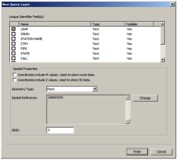
At ArcMap 10.0 Esri introduced query layers and at 10.1 they made tables with native geometry types pretty transparent to the end user. This means that any data that has an X and a Y can be pulled directly from that source. Instead of duplicating 911 or other incident data into your GIS database, now you can simply create a query layer in ArcMap referencing the other database. This prevents GIS from maintaining security on data that should be maintained by E911.
Join to other business systems
Assessing data is always a huge pain. Usually by the time the data makes it through the extract, transform and load (ETL) process into the GIS data, it is already out of date! Then the data might sit there for a week until the next ETL process updates the Tax Parcel feature class.
Wouldn’t it be great to create a live link to the assessor’s database with a spatial view to represent the join between Assessing data and spatial data? You can do this incredibly easily at 10.1 with the ability to create Spatial Views through ArcCatalog.

Create focused attribute editor apps
Often the data we would like to display simply does not exist in a format GIS can use. This calls for getting the folks with domain expertise to populate the data for us. A focused application that only allows for users to edit attribute information is a straight forward method for collecting this information without a ton of training.
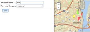
Need someone to fill out Park information? Simply roll out a simple attribute editing web app that allows park personnel to fill out what amenities are available at the park and what time the parks are open. BAM! It automagically updates in the locater app open to the public.
So yes, 90% of the world’s information is spatial, but it doesn’t mean we have to maintain it all!
